contact No: 08742-12997733
location: Kukatpally, Hyderabad.
info@m-joeygeosolutions.com
altenglish
  • altenglish
Medisch LogoMedisch Logo
altenglish
  • altenglish
  • Home
  • About Us
  • Careers
  • Services
    • Airborne LiDAR Data Processing
    • Mobile LiDAR Data Processing
    • UAV Lidar Data Processing
    • Power line Classification
    • Topographic/Land Mapping
    • Photogrammetry
    • 3D City Modeling
  • contact
Our Works Whatsapp

Mobile LiDAR Data Processing

Mobile LiDAR Data Processing

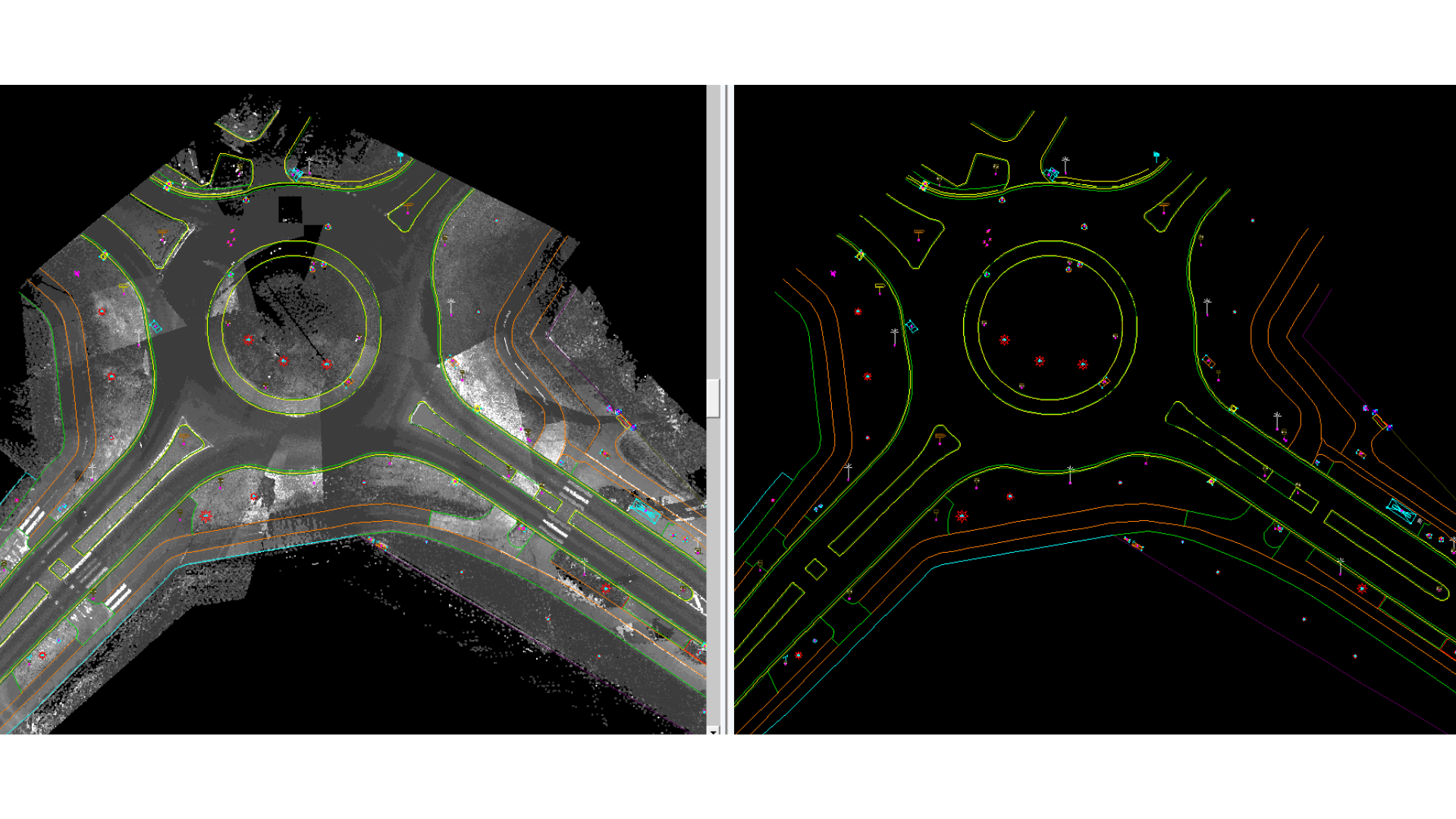
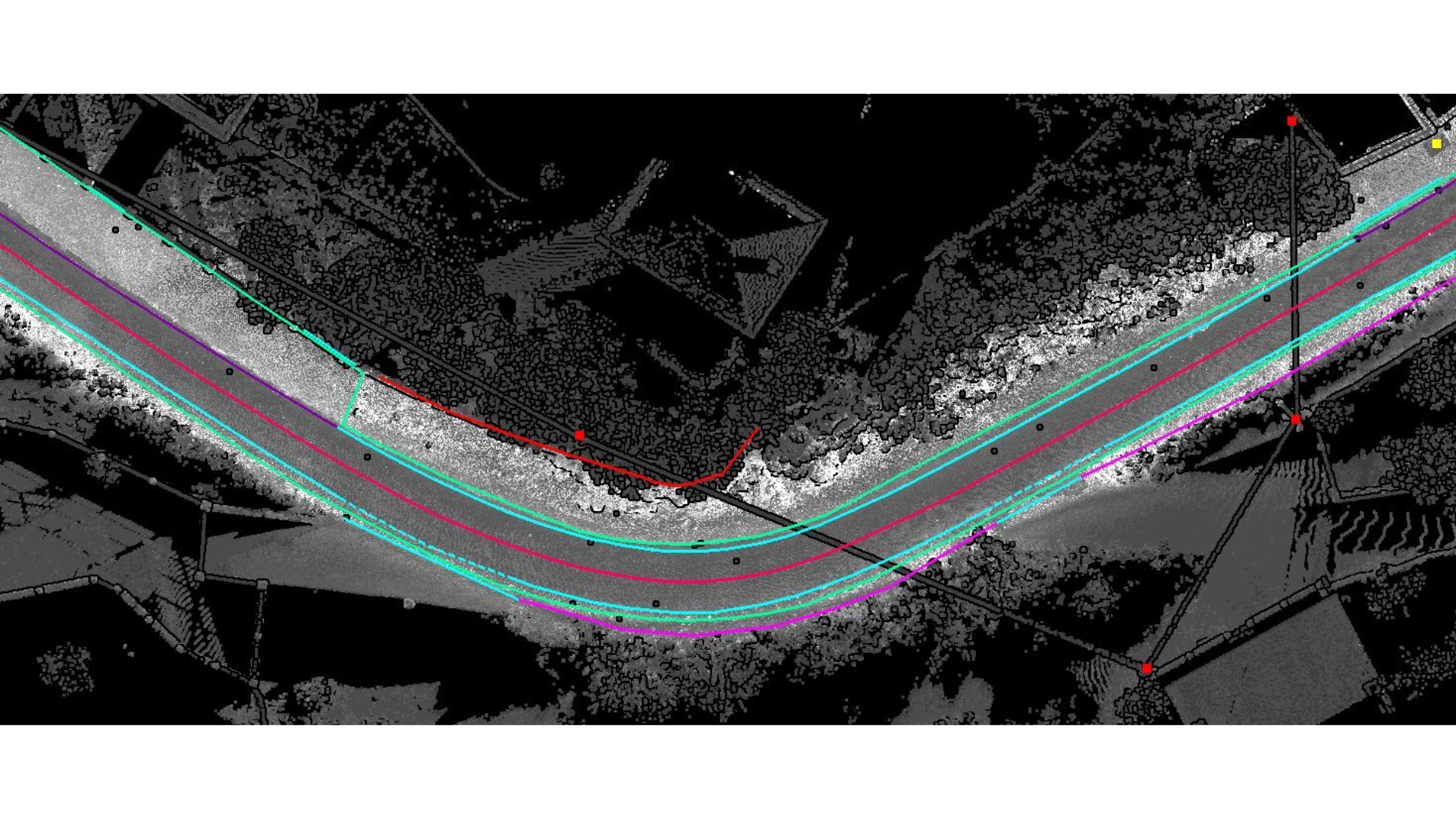
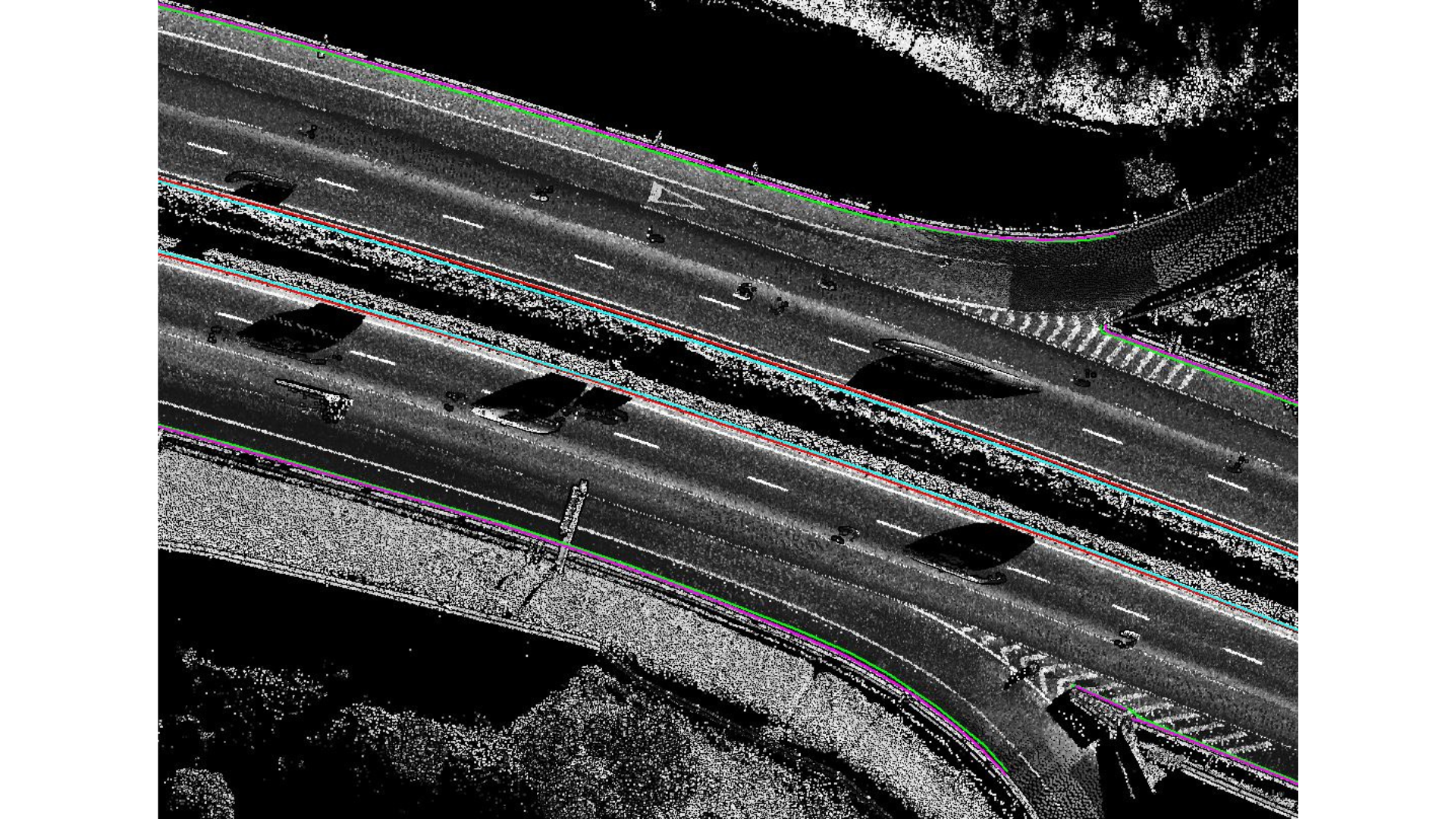
Mobile LiDAR Data Processing Services is an advanced mapping technique that utilizes survey-grade 3D point cloud data with remarkable speed and accuracy, utilizing advanced LiDAR sensors and cameras. Mobile LiDAR data mapping involves the collection of geospatial data from a mobile vehicle equipped with a LiDAR remote sensing system, facilitating rapid capture of all visible assets at desired speeds. Advanced technology is utilized for the further processing of the 3D point cloud data, including the extraction of ground and non-ground features, mobile flight line matching, 2D feature extraction, 3D corridor mapping, DSM, and intensity images.

quick contact

If you have any questions or need help, feel free to contact with our team.

  • 9963180263
  • Head Office: flat No: 207, HMT Rd, Allwyn Colony,Kukatpally, Hyderabad, Telangana 500072
get directions
Services
  • Power line Classification
  • 3D City Modeling
  • Airborne LiDAR
  • Mobile LiDAR
  • Topographic Surveying
  • Photogrammetry
links
  • Home
  • About Us
  • Services
  • Careers
  • Our works
  • Contact-Us
help
  • help & FAQs
  • contacts
  • careers
  • site map
newsletter
© M-Joey.Designed By Webiqra Pvt Ltd. all rights reserved.